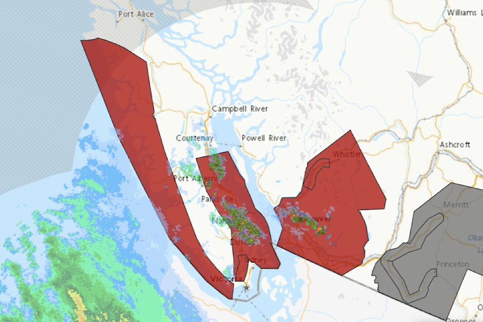
Both coasts of Vancouver Island are in for a soggy 24 hours as a Pacific frontal system is set to land Tuesday (Dec. 17).
Up to 100 mm of rain is expected up the west coast of the Island with up to 50 mm set to fall on the east from the Malahat to Fanny Bay and the Southern Gulf Islands, according to Environment and Climate Change Canada.
B��Ԫ������ַ�High flows and localized flooding are possible, particularly at lower elevations and in areas with poor drainage,B��Ԫ������ַ� the weather agency said in a warning issued shortly after 5 a.m.
The Ministry of Water, Land and Resource Stewardship also issued a high streamflow advisory for the south and west coast of the Island
Elevated freezing levels accompanying the storm will generate rainfall and snowmelt at low to mid-elevations, particularly for Vancouver Island.
Current forecast rainfall is typical for fall/winter storms in the region but will likely be high intensity, falling in a relatively short period of time, the advisory notes.
B��Ԫ������ַ�Rivers are anticipated to respond quickly to rainfall and snowmelt, with rapid increases beginning on Tuesday. Currently, hydrologic modelling is indicating the potential for peak flows up to the 2-year to 5-year return period range, but peaks may be higher. Going into the storm, rivers across the South Coast and Vancouver Island are generally at near normal to above normal seasonal levels.B��Ԫ������ַ�
The rain is expected to ease Wednesday morning.


