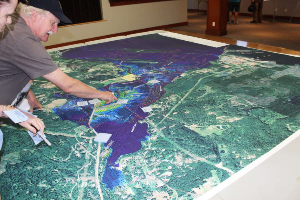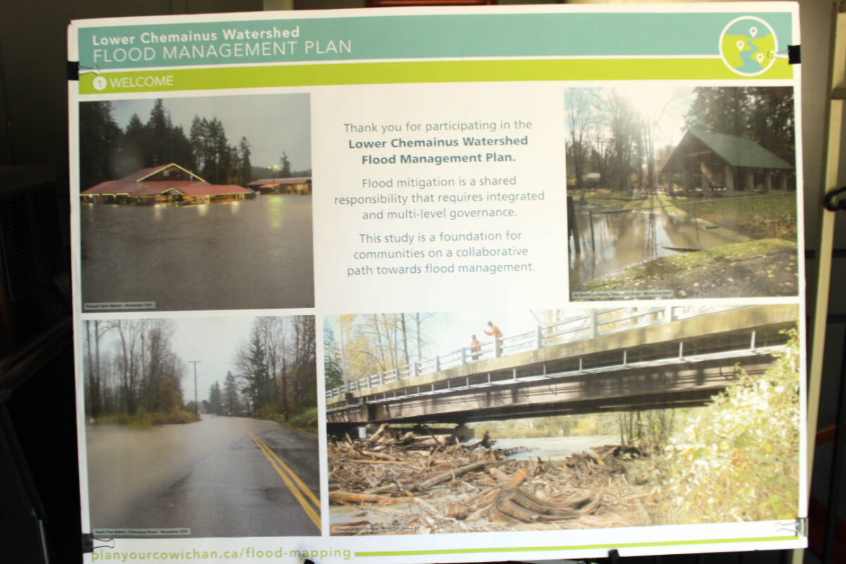
Residents received their first chance to view maps of the lower Chemainus River watershed flood mapping process and the presentation of early ideas for flood mitigation planning last Wednesday at the Crofton Community Centre.
Cowichan Valley Regional District staff was on hand to expand on the details and answer questions.
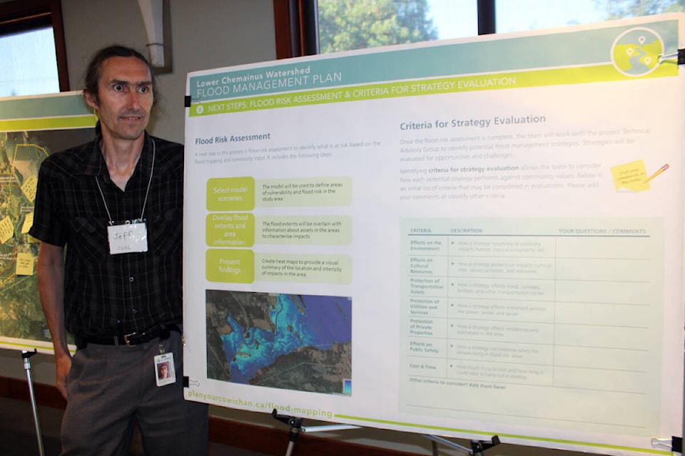
The project is funded primarily through a grant from the National Disaster Mitigation Program, with equal contributions from the federal and provincial governments, explained Jeff Moore, senior environmental analyst for the Cowichan Valley Regional District.
The CVRD and Municipality of North Cowichan contributed additional funding for the project that began in May 2021.
The first phase B��Ԫ������ַ� modelling and flood mapping B��Ԫ������ַ� was completed in June and the second phase involving the development of mitigation options and a flood management plan is now underway. ItB��Ԫ������ַ�s expected the project will conclude in late fall of 2022 or early winter 2023.
The work is being done as a partnership between the CVRD, North Cowichan, Halalt First Nation and Penelakut Tribe.
The last flood mapping of the Chemainus River was done by the province in 1990. Since then, a lot has obviously changed in the watershed, Moore pointed out, including: increased development and changing land use both on the floodplain and upstream; physical changes in the river as all streams change over time and move within the floodplain, with sediment and debris accumulating; and increases in the amount and intensity of rainfall due to climate change mean plans have to be made for larger floods than experienced historically.
B��Ԫ������ַ�In addition to changes to the floodplain, advances in technology over the past 30 years allow for much more accurate mapping and more complex modelling of the floodplain and how water flows within it,B��Ԫ������ַ� added Moore. B��Ԫ������ַ�Similarly, the standards for what is required of flood mapping have changed.
B��Ԫ������ַ�The purpose of the mapping was to provide up-to-date flood mapping that takes into account all of the above. The mapping identifies the extent of a potential one-in-200-year flood, the depth and velocity of the floodwaters, and the level at which buildings should be constructed in order to be safe from flooding.B��Ԫ������ַ�
There have been some interesting findings already, with the mapping showing the extent of the flood hazard for a one-in-200-year flood being an even bigger flood than those experienced in 2020 and 2021.
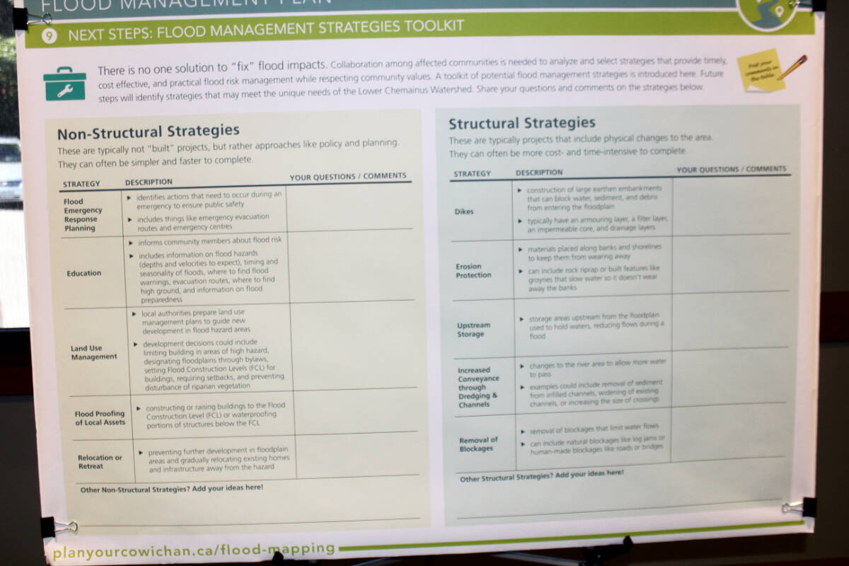
B��Ԫ������ַ�The mapping shows both the depth and the velocity of the flood waters so we can see which parts of the floodplain are most at risk from deep and/or fast-moving floodwaters,B��Ԫ������ַ� Moore indicated. B��Ԫ������ַ�The mapping clearly shows that during a significant flood, pretty much the entire lower valley from the Chemainus River across to Bonsall and Whitehouse Creeks will experience flooding. This shows the magnitude and complexity of the problem and unfortunately also shows that there is no quick and easy solution that will B��Ԫ������ַ�solveB��Ԫ������ַ� the problem. One of the most useful tools from the first phase of the project is the computerized flood model. This tool will allow us to test out different mitigation options to see both how effective they may be at protecting homes, farms and other infrastructure, as well as what other impacts may result in surrounding areas.B��Ԫ������ַ�
While there are no immediate solutions to all the problems on the river, the project will develop a long-term flood management plan. The flood mapping and modelling gives the baseline understanding of the extent and severity of flooding that would be anticipated from a one-in-200-year flood.
B��Ԫ������ַ�This computerized flood model that was developed in the first phase will now be used to evaluate different flood mitigation options,B��Ԫ������ַ� Moore pointed out. B��Ԫ������ַ�We had engagement sessions with people who live in the floodplain as well as with representatives from the federal and provincial government and other agencies with interests in the area. We heard a lot of great suggestions for possible steps that can be taken to reduce the risk of future flooding. We also heard a strong message that something needs to be done now to help people who were affected by the past flooding and to protect against the possibility of another flood.
B��Ԫ������ַ�We recognize the need for action, and while there are likely some immediate steps that can help to some extent, the focus of this work is on the bigger, longer-term solutions that will be needed to protect the community from future floods. The mapping and modelling that we presented this week shows the magnitude of the potential flooding and tells us that we need to look at larger, longer term actions. The long-term flood management plan will look at a whole range of possible mitigation options, both short and long-term. Having this plan is an essential first step to be able to seek out funding for the types of projects that will be needed to protect the community.B��Ԫ������ַ�
The floodplain includes lands within the Municipality of North Cowichan, along with Halalt, Penelakut and StzB��Ԫ������ַ�uminus First Nations. Other stakeholders include both provincial (Emergency Management BC, MoTI, FLNRORD) and federal governments (Indigenous Services Canada, Fisheries & Oceans Canada), the Island Corridor Foundation and Mosaic Forest Management.
B��Ԫ������ַ�All of the different stakeholders have responsibility for different aspects of flood management, disaster mitigation, recovery and may have access to different resources, funding sources, etc.,B��Ԫ������ַ� Moore noted. B��Ԫ������ַ�We are continuing to work to bring everyone to the table to work together towards the common goal of flood mitigation.B��Ԫ������ַ�
The CVRD is inviting feedback until Aug. 2. People can visit https://www.planyourcowichan.ca/flood-mapping to share their experiences with the flooding and suggestions for the future.
B��Ԫ������ַ�This information will be used both for a risk assessment B��Ԫ������ַ� identifying what is important to the community and what is at risk due to flooding B��Ԫ������ַ� and to develop and evaluate possible mitigation options,B��Ԫ������ַ� Moore summed up. B��Ԫ������ַ�Over the next few months, these suggestions, along with the input from technical experts and other stakeholders, will be used to develop a flood management plan for the floodplain. We will be coming back to the community later in the fall to get feedback on this plan.B��Ԫ������ַ�
don.bodger@chemainusvalleycourier.ca
Like us on and follow us on .